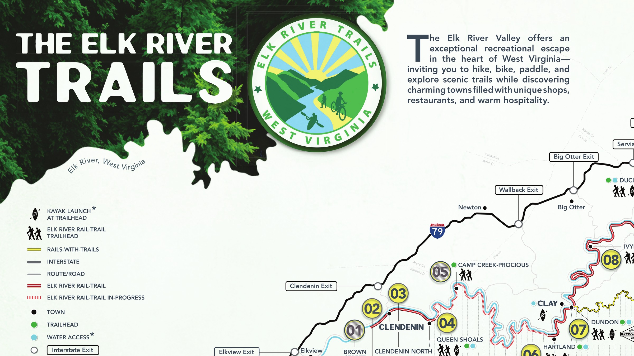
Maps and merchandise for the foundation stewarding the Elk River Trail — promoting entrepreneurial effort along a multimillion-dollar recreation corridor.
The Elk River Trail Foundation is citizens and businesses along the corridor, stewarding the trail system on the Elk River and Buffalo Creek — its mission to preserve, protect and enhance it for public recreation, community health, conservation, education, economic development and cultural enrichment. What the Foundation did not have was a drawing of the thing it stewards. The trail runs 73.3 miles through thirteen trailheads between Clendenin and Gassaway, and there is no vantage point anywhere on it. The map is the only place the whole trail exists at once, which means one sheet has to serve as wayfinding, as an economic argument, and as marketing.
I built this from source data rather than tracing an existing map. USGS hydrology and infrastructure were pulled and cleaned in QGIS, then imported into Rhino, where I stripped what the map did not need and redrew what it did not have — trailhead markers, town locations, roads corrected to what is actually on the ground. Trailhead positions came from coordinates the Foundation verified on site, cross-checked against satellite imagery, so the sheet is accurate enough to navigate by. Make2D generated the linework out to Illustrator, where my existing layers were converted to Live Paint and filled against a legend drawn for them. Photoshop and InDesign carried the imagery and the assembly — the two trail photographs masked with the river's own linework, the Foundation's logo over a title image keyed to the same palette. Every trailhead on the finished sheet links to its own page on elkrivertrail.org. Reviewed throughout with the Foundation's board and leadership.
The trail is a palimpsest.
DuPont laid the railbed in the 1920s and abandoned it in 2015; the state converted it into 73.3 miles of recreation trail. Mapping it meant reading a century of infrastructure and deciding what stays legible — the same editorial act as any brand system, at the scale of a river valley.
Accuracy is a supply chain.
The drawing is only as good as the worst number in it, and the numbers came from four places — USGS, satellite imagery, the roads as they actually run, and coordinates the Foundation walked out and confirmed. Someone will stand at a trailhead holding this, which is a different standard than a map that only has to look right.
Everything true is not everything shown.
River, railbed, rails-with-trails, interstate, road, town, exit, water access and kayak launch all occupy the same valley and the same inch of paper. Offsetting those lines so three things running together for 73.3 miles still read as three things — and ruling on what stays on the sheet against what moves to the website — was the hardest part of the job and the part nobody sees.
The legend at the bottom is the part I would defend.
You cannot read distance off a river. So the trailheads are laid out a second time as a straight horizontal sequence with the mileage between each pair, which answers the only question anyone actually asks — how far to the next one — without making them measure anything.
One drawing, three deliveries.
It had to print, live on the site with every trailhead linked to its own page, and survive being sent to someone as a file. Three separate versions would have drifted apart inside a year.
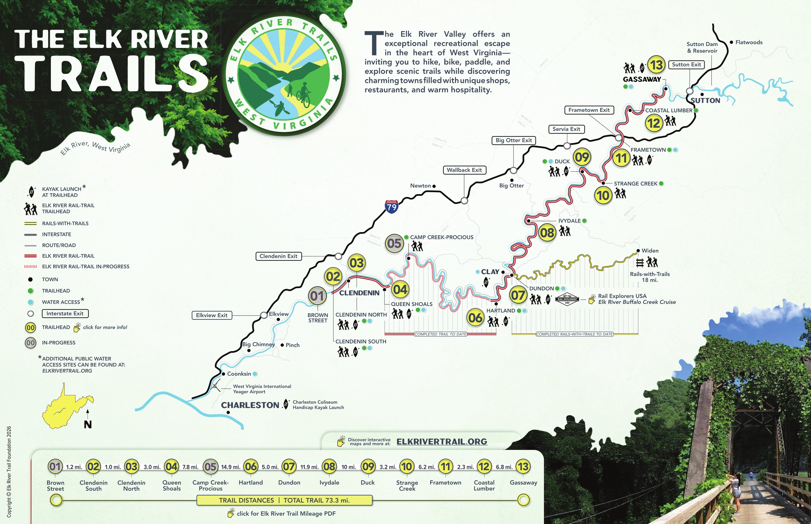
This map is unmistakably part of the Elk River Trail Foundation system, and its interactivity brings users straight to the additional information that cannot be placed legibly on the map.
This map is unmistakably part of the Elk River Trail Foundation system, and its interactivity brings users straight to the additional information that cannot be placed legibly on the map.
This map is unmistakably part of the Elk River Trail Foundation system, and its interactivity brings users straight to the additional information that cannot be placed legibly on the map.

The map is the only place the whole trail exists at once.
The map is the only place the whole trail exists at once.
The map is the only place the whole trail exists at once.

The horizontal legend — thirteen trailheads laid out a second time in sequence, with the mileage between each pair.
The horizontal legend — thirteen trailheads laid out a second time in sequence, with the mileage between each pair.
The horizontal legend — thirteen trailheads laid out a second time in sequence, with the mileage between each pair.
You cannot read distance off a river. So the trailheads are laid out a second time as a straight horizontal sequence with the mileage between each pair, which answers the only question anyone actually asks — how far to the next one — without making them measure anything.
You cannot read distance off a river. So the trailheads are laid out a second time as a straight horizontal sequence with the mileage between each pair, which answers the only question anyone actually asks — how far to the next one — without making them measure anything.
You cannot read distance off a river. So the trailheads are laid out a second time as a straight horizontal sequence with the mileage between each pair, which answers the only question anyone actually asks — how far to the next one — without making them measure anything.
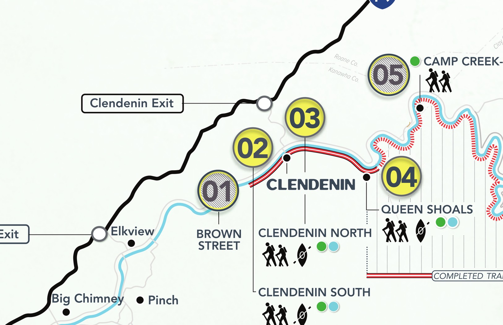
Clendenin — trailheads 01 through 04, Brown Street to Queen Shoals.
Clendenin — trailheads 01 through 04, Brown Street to Queen Shoals.
Clendenin — trailheads 01 through 04, Brown Street to Queen Shoals.
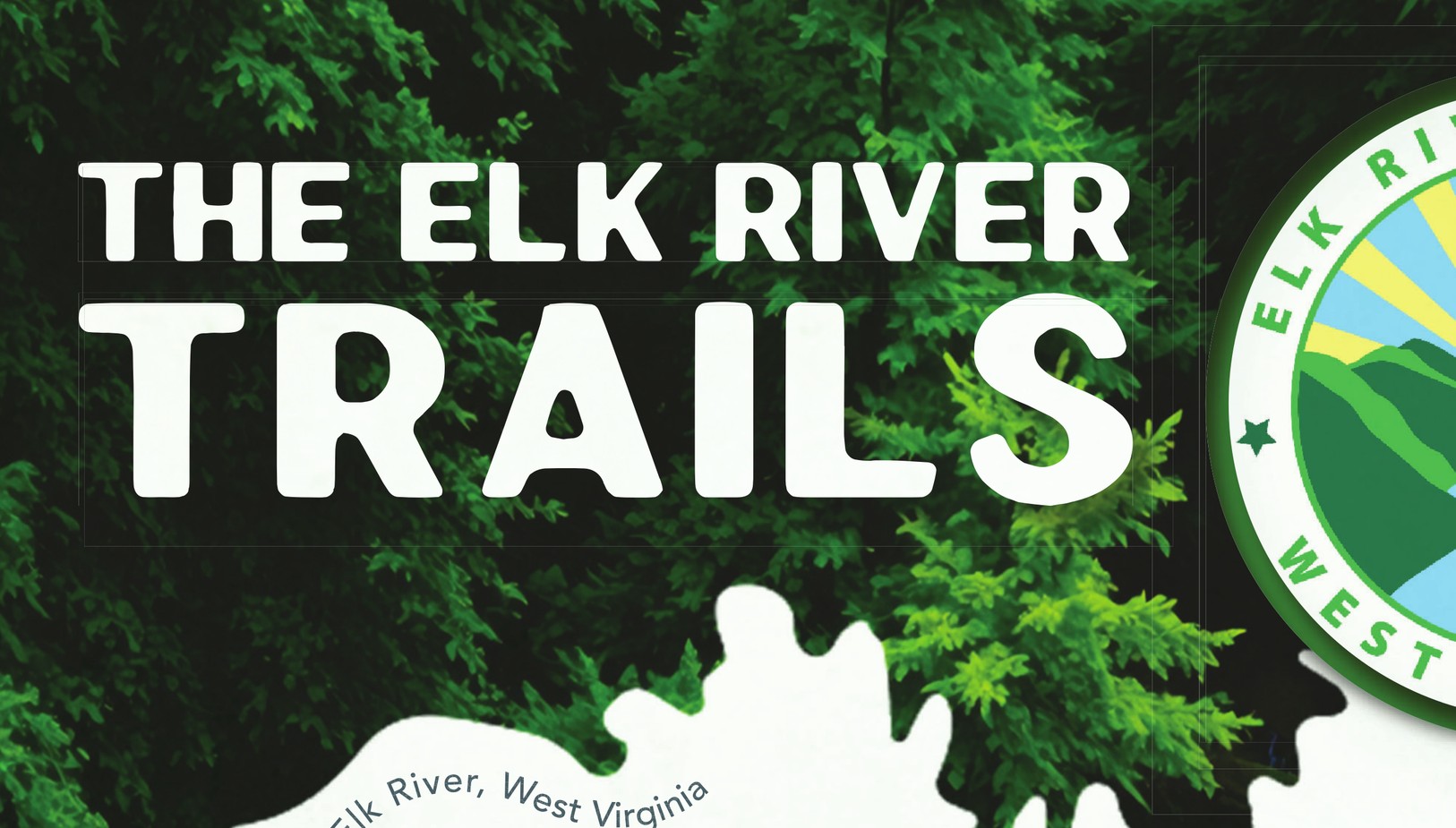
The Foundation's logo over a title image keyed to the map's palette.
The Foundation's logo over a title image keyed to the map's palette.
The Foundation's logo over a title image keyed to the map's palette.
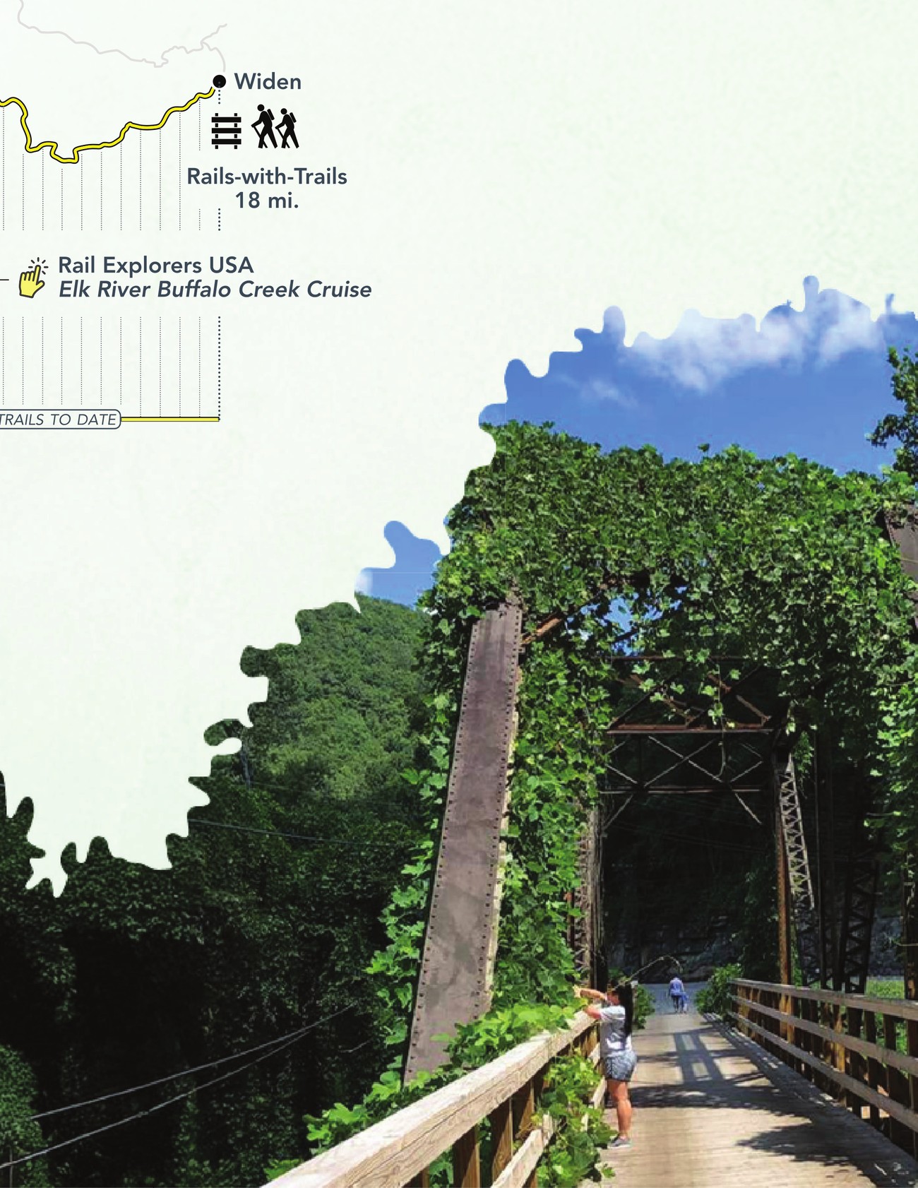
Trail photograph masked with the river's own linework.
Trail photograph masked with the river's own linework.
Trail photograph masked with the river's own linework.
Someone will stand at a trailhead holding this, which is a different standard than a map that only has to look right.
Someone will stand at a trailhead holding this, which is a different standard than a map that only has to look right.
Someone will stand at a trailhead holding this, which is a different standard than a map that only has to look right.
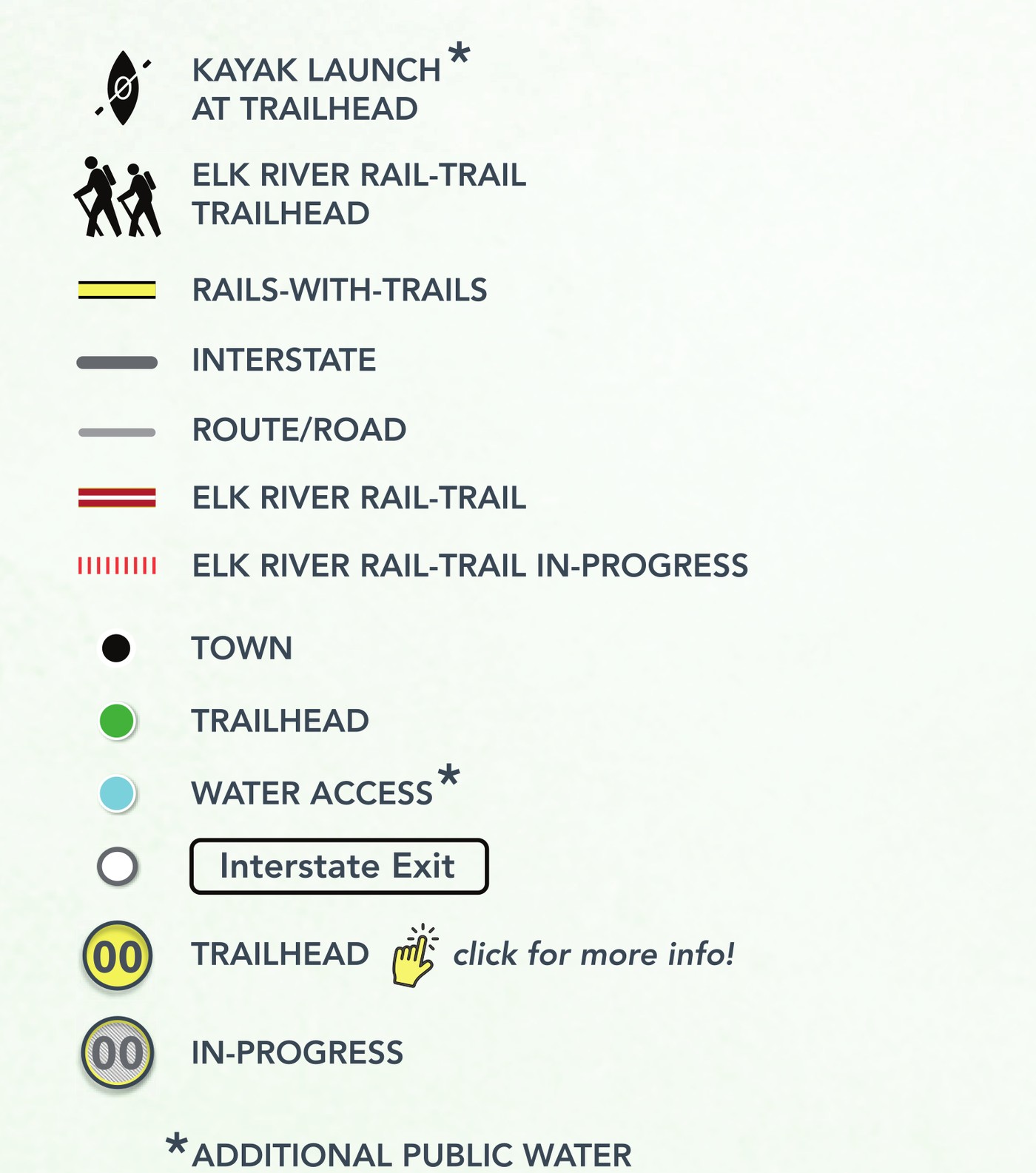
Legend — kayak launch, rail-trail, rails-with-trails, interstate, route, in-progress track, town, trailhead, water access.
Legend — kayak launch, rail-trail, rails-with-trails, interstate, route, in-progress track, town, trailhead, water access.
Legend — kayak launch, rail-trail, rails-with-trails, interstate, route, in-progress track, town, trailhead, water access.